Thesis: Crosswalk detection – Karatzaferis
-
Intro
-
Technical Aspects
Information
| Primary software used | Jupyter Notebook |
| Course | Thesis: Crosswalk detection – Karatzaferis |
| Primary subject | AI & ML |
| Secondary subject | Machine Learning |
| Level | Advanced |
| Last updated | November 27, 2024 |
| Keywords |
Responsible
| Faculty |
Thesis: Crosswalk detection – Karatzaferis 0/1
Thesis: Crosswalk detection – Karatzaferis
Crosswalk detection for the outdoor navigation of people with visual impairment by Odyssefs Karatzaferis
The aim of this study is to utilise freely available aerial imagery and spatial data to identify the location of pedestrian zebra crosswalk in an area. This will ultimately allow improved, independent navigation for people who are visually impaired by helping to adjust a route to consider crosswalk locations and ensure that everyone can walk across roads more safely. The main steps towards building the proposed system include:

- Collecting training imagery dataset
- Choosing an appropriate algorithm
- Image quality control, grouping and labelling the images
- Implementing and training the CNN model
- Evaluating initial results
- Data augmentation
- Model fine-tuning
- Applying the trained model to crosswalk detection in Delft
- Testing model with different spatial resolution imagery
Here you can find the document of the full master thesis ‘Crosswalk detection for the outdoor navigation of people with visual impairment’.
Project Information
Author(s): Odyssefs Karatzaferis
Year: 2022
Project type: Master thesis, GIMA
Keywords: Convolutional Neural Networks
Topic tags: Object detection, Data augmentation
Thesis: Crosswalk detection – Karatzaferis 1/1
Technical Aspectslink copied

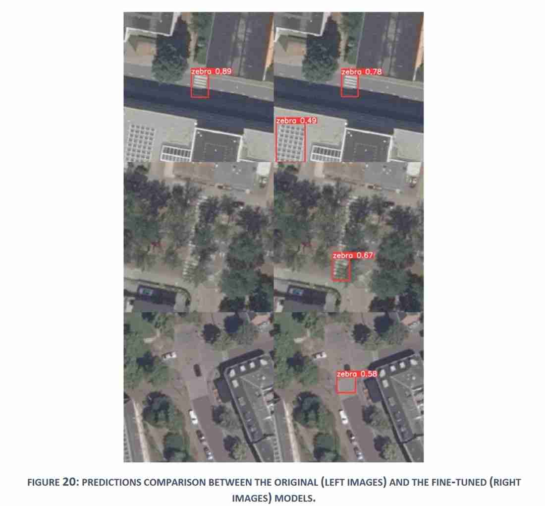
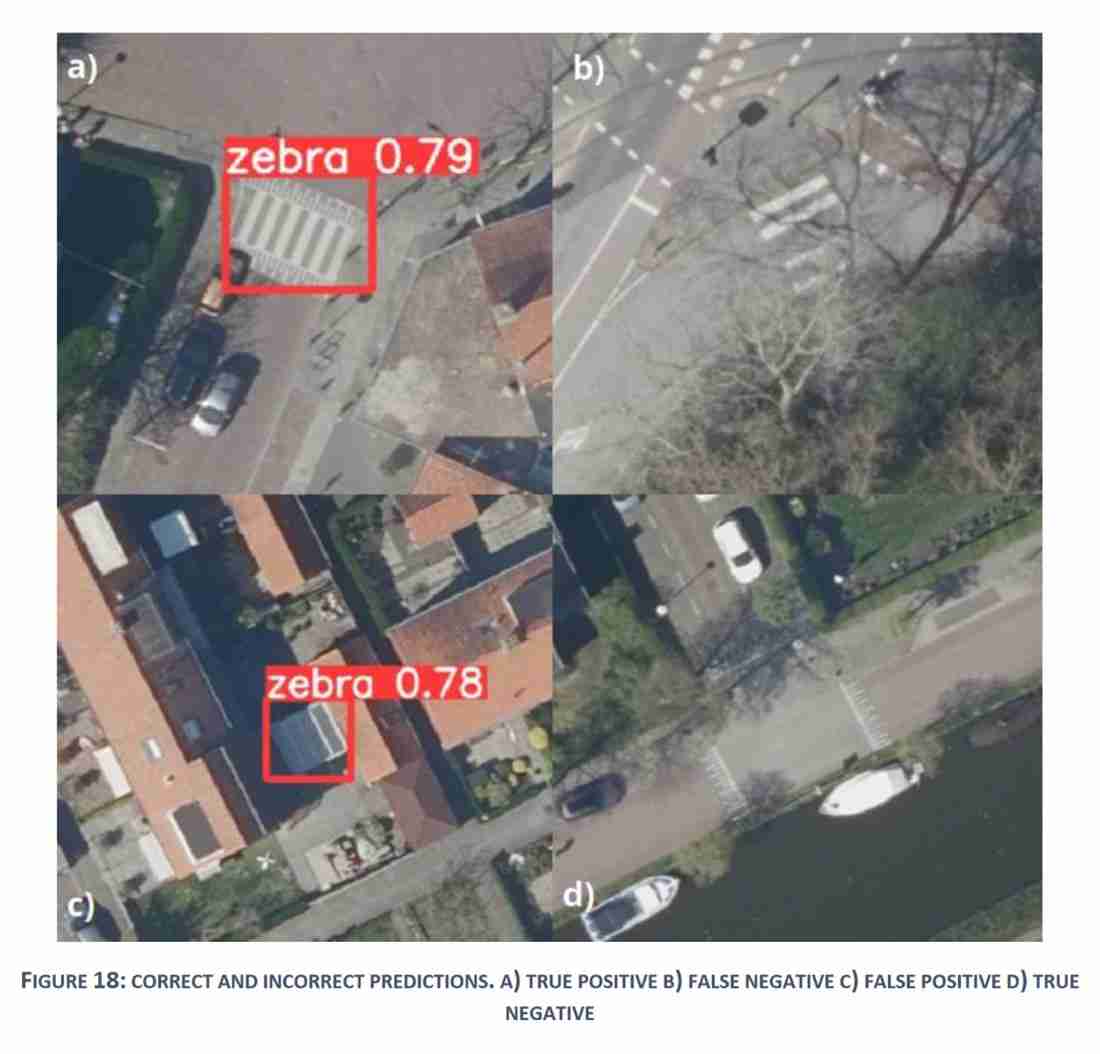
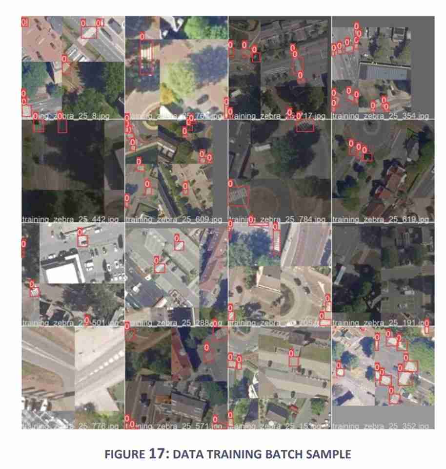
The model exhibited a tendency to misidentify non-crosswalk linear objects as crosswalks, resulting in many false positive predictions. This issue was found to be caused by unclear training data. Data had been included which not only explicitly depicted roads, but also included wider urban and sub-urban regions where objects like windows and solar panels caused the model’s confusion. This can be solved by filtering the predicted crosswalk locations using a road buffer (which was done as part of this research), by pre-processing the detection dataset to filter out non-road areas or by including appropriate images as background true negative samples to the training dataset.

The trained model was also tested with imagery of higher spatial resolution and image quality than the ones used to train it. While some additional crosswalk locations were identified this way, predictions on the high-resolution image included a dramatically increased number of false positives. This was attributed to the sharper depiction of background linear objects due to the higher image quality and spatial resolution, making them more susceptible to misidentification. Training a new model with high resolution imagery with an appropriately sized true negative sample would possibly help reduce the number of erroneous predictions. Such an approach would however greatly increase computational demands and make the designed system unsuitable for real-time detection.
- OpenStreetMap and Overpass Turbo for collecting open-source geographic data
- PDOK for aerial imagery
- YOLOv5 for the pre-trained CNN model
- Python in a Jupyter notebook for coding
- Colab virtual environment for model training
- ESRI’s ArcGIS Pro for Pre- and post-processing & visualization
Write your feedback.
Write your feedback on "Thesis: Crosswalk detection – Karatzaferis"".
If you're providing a specific feedback to a part of the chapter, mention which part (text, image, or video) that you have specific feedback for."Thank your for your feedback.
Your feedback has been submitted successfully and is now awaiting review. We appreciate your input and will ensure it aligns with our guidelines before it’s published.
